California, the Golden State, is known for its diverse landscapes, bustling cities, and iconic landmarks. With such a vast area, understanding the zip codes across California can be incredibly useful for businesses, travelers, and residents alike. This article will delve into the details of California zip codes, providing valuable insights and resources to help you navigate the state more efficiently.
What Are Zip Codes?
Zip codes are a system of postal codes used by the United States Postal Service (USPS) to ensure mail is delivered accurately and efficiently. Each zip code corresponds to a specific geographic area, making it easier to sort and deliver mail.
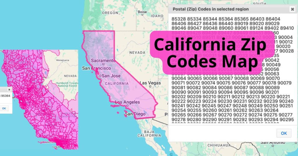
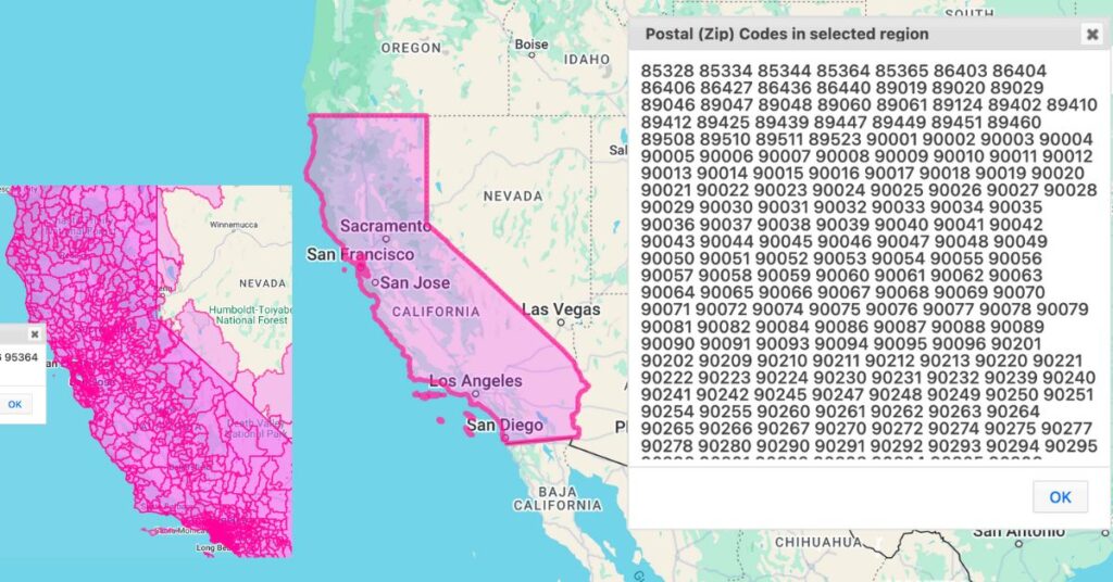
California Zip Codes Interactive Map
An interactive map can be a valuable tool for visualizing zip codes. For example, on ZeeMaps, you can easily create a map that showcases all of the zip codes in a region, like the one below. The map is separated by zip code into unique regions. You can click on each region to discover the list of zip codes associated with that region.
List of Major California Zip Codes
Here are some of the major zip codes:
- 90001: Los Angeles
- 94102: San Francisco
- 92101: San Diego
- 95814: Sacramento
- 92660: Newport Beach
You can view a complete list of California zip codes on the state website.
Create Your Own Zip Codes Map
You can make your own interactive map using ZeeMaps by following these steps.
- Highlight the state of California, using the Additions -> Highlight Regions -> States on your map.
- Then, select the menu item View -> Zip Code Lookup, and click an the highlighted California region. You’ll get a list of all zip codes in California.
- From there, you can go a step further and create a new region for each zip code. Choose Additions -> Highlight Region and then paste all of the zip codes you found in step two into the tool.
To make your map static instead of interactive, save it as a PNG or PDF. Simply use the Print or Share option, then click “PDF/PNG Image.” You can play around with the settings to get the image to look the way you want it to. With options like satellite image vs. map image, different pin aesthetics, image resolution, and size, there are various ways to customize your map using ZeeMaps.