We’ve added the ability to highlight and find postcodes in Australia. You can highlight postcodes, or find postcodes that are within a specific area on the map.
“Postcodes are used in Australia to sort and send mail to the correct address. All postcodes in Australia have four digits and are placed at the end of the address. Australian postcodes are managed by Australia Post.” from the Wikipedia article on postcodes in Australia.
Highlight Postcodes in Australia
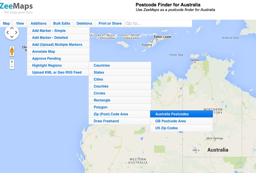
To highlight one more Postcodes in Australia, use the Additions -> Highlight Regions -> Zip (Post) Codes -> Australia Postcodes menu item on your map.

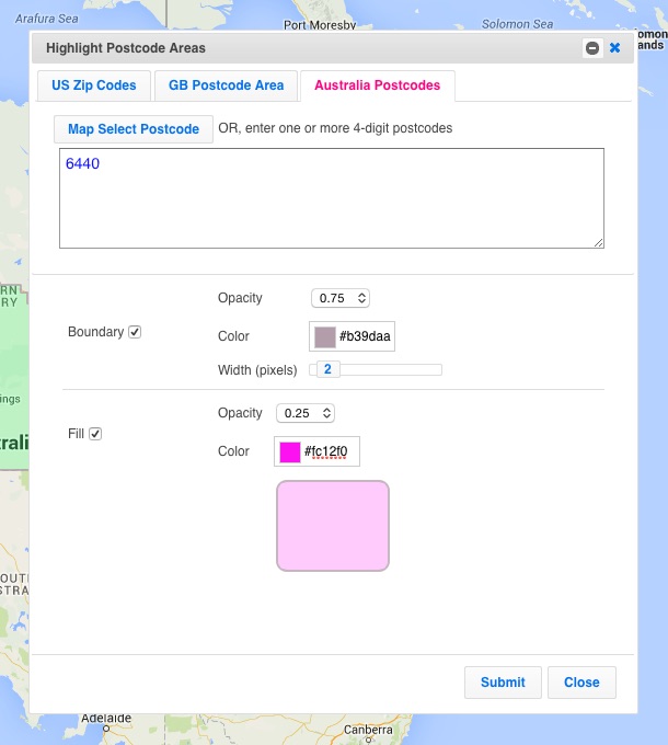
In the resulting dialog, enter one or more four digit postcodes separated by commas or spaces. Specify the color for the highlighted area and the boundary and hit Submit.

For example, here’s a map with postcodes 0872 and 6440 highlighted.
Postcode Finder for Australia
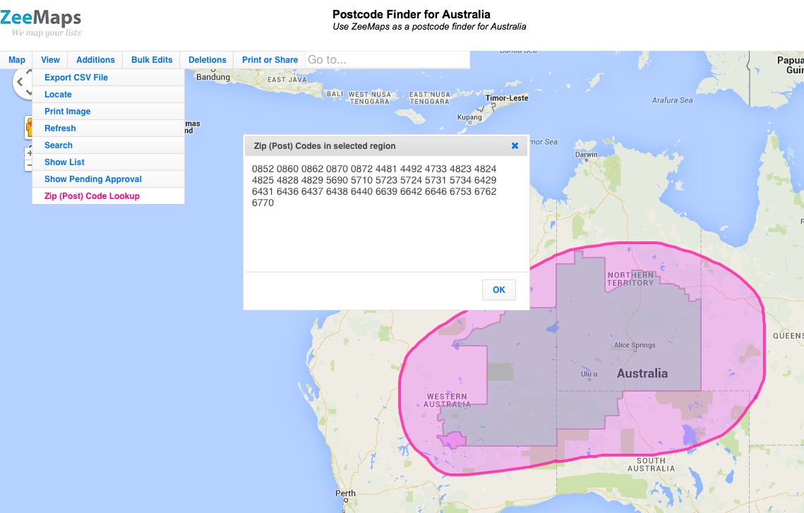
To lookup postcodes that are in a specific area in Australia, use the Additions -> Highlight Regions to define your region. Then, use the menu View -> Lookup Zip (Post) codes menu item and click on your highlighted region. That should show you a list of all the postcodes that fall in the given region.
