ZeeMaps allows you to measure the distance and Google Maps routing between two points:
- You can connect two pins with a straight line or route, and show the distance in Kilometers or Miles.
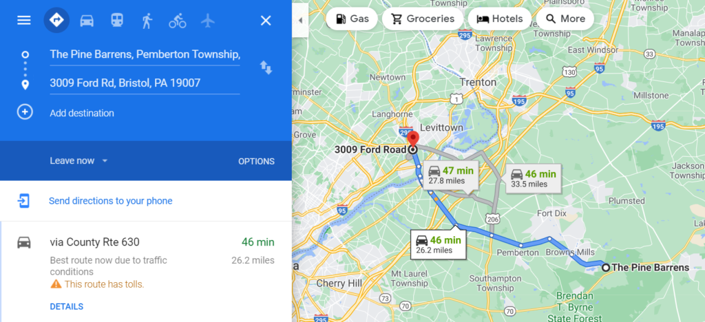
- Click on a pin to get its information bubble, then click on Directions (From Here or To Here). This allows you to specify the start or end destination by entering an address or selecting a location on the map. Then, a directions request to Google Maps gives you turn-by-turn directions including the distance and duration.
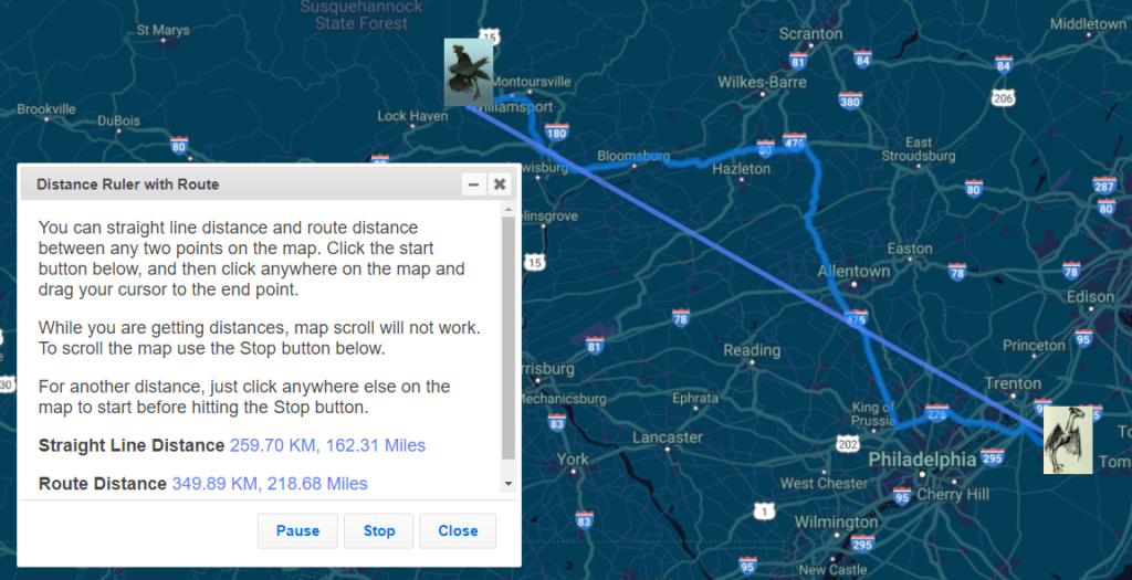
We’ve added a Distance Ruler to ZeeMaps that allows you to quickly get the distance between any two locations on the map. The resulting distance is specified both for a straight line distance and a route distance.
Use the menu item View -> Distance Ruler on your map to get the distance ruler.

Then, from the prompt, click on the ‘Start’ button in the ruler to start measuring.

Click anywhere on the map and drag your mouse to the destination. You receive the distance between those two points.

For another set of two points, click anywhere else on the map and repeat the drag to the next location.
Once you click on the Start button:
The map stops responding to normal clicks and drags for zooming and panning.
To temporarily re-enable these features while you are measuring distances, e.g., to re-position the map, you can hit the ‘Pause’ button on the distance ruler.
Measure Distance with Google Maps Routing
Click on your map pin. Then choose from Directions From Here or To Here.

This allows you to specify the start or destination, by entering an address or selecting a location on the map.

Then, a directions request to Google Maps will give you turn-by-turn directions including the distance and duration.

Try out our new tool and let us know how it works out for you!