Geo Maps Overview
Often, it is useful to show continuously updated geo maps. For example, geo maps updated by a large number of field operators. In the field, operators can indicate status change for job sites by changing the color of markers on the geo map. Similarly, crowdsourced geo maps would show updates from the field as new locations are added. For such geo maps, it is often desirable to display the geo map on a large screen, visible to several users and employees to monitor progress. This can also be useful in conferences, e.g., where each attendee marks their location of origin or interest. In classrooms, you can use such geo maps for students to mark their locations.
Manually refreshing the geo map screen every so often becomes tedious quickly. It is much better if the geo map can refresh itself every few minutes.
ZeeMaps allows you to set up your geo map for auto-refresh. Once set up for auto-refresh, you can leave the geo map visible on a browser window and it will automatically refresh itself every five minutes.
Enabling Auto-Refresh for Geo Maps in ZeeMaps
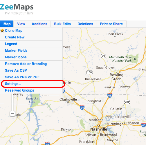
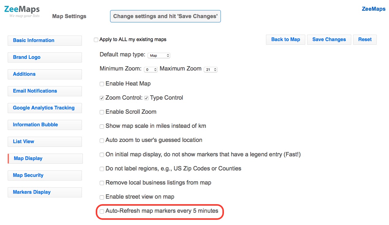
To enable auto-refresh of your geo maps, use the Map -> Settings menu to go the settings page. Click on the Map Display tab in the settings page. Check the box for “Auto-Refresh map markers every 5 minutes”. Hit Save Changes.


To recap, ZeeMaps provides many ways of making changes to geo map markers concurrently by many users. Users can add more locations to a geo map. They change the status of a geo map marker by changing its color. Manually refreshing the geo map on a continuous basis is tedious. ZeeMaps’ capability auto-refreshed every few minutes makes it much easier to setup overview geo maps for a groups of users.