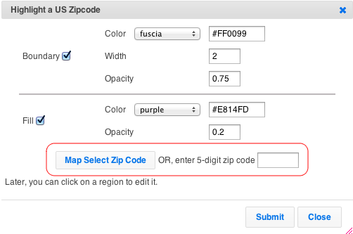
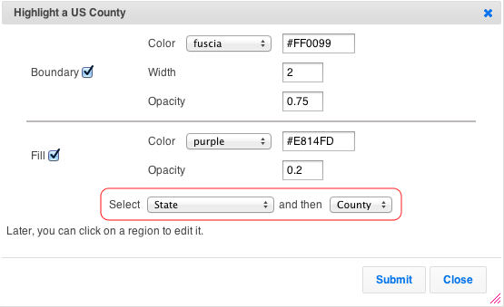
Use the Additions -> Highlight US County, or Additions -> Highlight US Zip Code to color any zip or county in the US.
For Zip Codes, you can either specify a five digit zip. Or, click on the map to get the value for locations.
For Counties, select a state and county.
As all highlighted regions in ZeeMaps, counties and zip codes regions have a boundary and fill, which can be customized for color, etc..
Once you’ve created a region, you can make changes to it by accessing your map as Admin. Then, click on a region to modify it. In the case of countries, states, counties, cities, or zip, you can change the boundary and fill coloring at any time. With hand-drawn regions, you can also change the shape. For radius regions, you can additionally change the size and location.
For example, below is a map of Los Angeles with the famous 90210 (Beverly Hills) area highlighted.
The highlighted regions work both on the interactive maps and the static images, as shown in the image below.
Find your Zip Code data
Under the OPEN Government Data Act, which is Title II of the Foundations for Evidence-Based Policymaking Act, government data is required to be made available in open, machine-readable formats, while continuing to ensure privacy and security.
You can search Data.gov from its catalog of government data from across the Federal Government. Once in the catalog, to find datasets you can:
- Enter keywords in the search box.
- Browse on the left side through types, tags, formats, groups, organization types, organizations, and categories. Clicking on multiple items narrows your search. You can click on the “x” to the side of any single item to remove it from the search, or “clear all” to remove all selected items in a category.
- Search by geospatial area by drawing a boundary box on the map at the left side and clicking “Apply” to find all datasets that are tagged for that geographic area.
Click here for more information on locating zip code data


Hello, if I were to purchase the Enterprise plan, would there be a way to enter zip code ranges to highlight. For example, could I type in that I want all zip codes between 20000-21499 and 22000-22399 (what some people call the “DC Area). If not, would I be able to create a quick list in MS Excel and copy/paste that list into a table?
Hi Ben,
We don’t support ranges, but you can certainly use the copy-and-paste of a list for our spreadsheet upload: https://content.zeemaps.com/blog/las_vegas_zip_codes_on_a_map/
Contact us if we can assist.
Hi, we’re Enterprise Users and we need to crete Zip code area maps in the US, AU and UK. We do have about 20 000 Zip codes to upload.
So how do I bulk-upload zip-code regions? (I can only find bulk-upload for markers)
Thank you!
I don’t have “highlight us zip code” in my dropdown for additions. any idea why?
We’ve changed the menu slightly. Look under Additions -> Highlight Regions -> Zip (Post) Code Area -> US Zip Codes.
It will not let me highlight no more than five counties…
Hi, the Basic (free) plan allows a maximum of five highlighted regions on any map. You’ll need to upgrade to an appropriate plan for more counties: Professional (10), Professional Publisher (25), or Enterprise (Unlimited).
I’m trying to figure out if via API or a synced Google spreadsheet if I can add counties based strictly on a ‘State’ and ‘County’ entry. I have a registration form in Formstack that allows registrants to select their counties. This then creates a row in my google doc with just ‘state’ and ‘counties’ (counties are comma separated in one cell). Is it possible to have Zeemaps plot the counties from the comma separated cell?